
Why Network Level Planning Needs Network Level Data
A road network does not fail at a single point in isolation, it fails as a system, where congestion at one junction ripples outward to affect routes several kilometres away. Planning authorities across the UAE have shifted their thinking accordingly, moving from isolated site studies toward network wide modeling that captures how demand moves across an entire corridor grid rather than one intersection at a time.
This systems level view is essential when a single new development, transit line, or road closure can shift travel patterns across dozens of connected routes, something a narrow single site study was never designed to anticipate.
Automated Traffic Counts (ATC) Across a Citywide Network
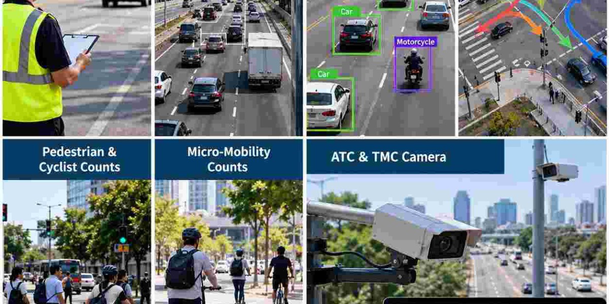
Building an accurate model of how an entire network behaves starts with volume data gathered simultaneously at many points, which is exactly the role Automated Traffic Counts (ATC) play in a network scale study. Deploying ATC equipment across dozens of locations at once captures a synchronized snapshot of demand that planners can feed directly into citywide transport models.
Synchronized timing matters more at the network level than it does for a single site study, since comparing volumes recorded weeks apart at different locations can distort the picture of how traffic actually redistributes itself across a connected grid of roads.
Classified Vehicle Counts for Freight and Network Capacity Models
Strategic transport plans increasingly separate freight movement from general traffic when modeling future network capacity, and Classified Vehicle Counts gathered across key corridors give planners the vehicle mix data needed to build that separation accurately. Understanding where heavy vehicles concentrate helps planners dedicate capacity or routing away from residential corridors toward purpose-built freight routes.
This data becomes especially valuable when a network plan proposes rerouting freight away from a growing residential district, since planners need solid evidence that an alternative route actually has the capacity to absorb the heavy vehicle volume being redirected onto it.
Turning Movement Counts (TMC) and Network Wide Signal Coordination
Individually optimized junctions can still create a poorly performing network if their signal timings are not coordinated with neighbouring intersections, which is why Turning Movement Counts (TMC) gathered across an entire corridor are used to model coordinated signal timing rather than junction by junction fixes. This network level view lets planners design green wave corridors that keep traffic moving smoothly across several connected intersections at once.
Coordinated signal planning of this kind delivers measurable network wide benefits, often reducing overall travel time and fuel consumption across a corridor far more than isolated improvements at individual junctions ever could.
Building Multimodal Networks Around Real Walking and Cycling Patterns
A modern road network plan is judged on far more than vehicle capacity, and Pedestrian & Cyclist Counts gathered across a study area give planners the evidence needed to design connected walking and cycling networks rather than isolated, disconnected path segments. Mapping where people already walk and cycle at the network level reveals missing links that a single site study would never surface.
Alongside these counts, Micro-Mobility counts tracked across multiple locations reveal how scooter and light electric vehicle trips connect across a wider area, data that is increasingly shaping how UAE cities plan dedicated lane networks rather than isolated local facilities.
Camera Verified Data Supporting Major Network Investment Decisions
Network level infrastructure investment decisions carry some of the largest budgets in a city's transport program, so the evidence behind them needs to withstand close scrutiny from funding bodies and technical reviewers alike. An ATC & TMC Camera setup deployed across a network study provides exactly that assurance, recording continuous footage so any volume or movement figure can be verified against a time stamped clip during a technical review.
This verifiable foundation is particularly valuable when a network plan recommends a major capital investment such as a new interchange or transit corridor, since funding bodies want confidence that the underlying demand case reflects genuine field conditions rather than modelled assumptions alone.
A Network Scale Survey Partner Across the UAE
Consultancies and planning authorities delivering citywide Traffic Surveys UAE programs need a field partner capable of mobilizing many simultaneous count locations across a wide study area within a tight planning timeline. Planning teams can explore the complete range of network scale traffic survey services before scoping a citywide data collection program.
Modeling Dubai's Growing and Changing Network
With new corridors, transit lines, and development districts constantly reshaping travel patterns across the emirate, planning teams running Traffic Surveys Dubai programs at the network level need current data rather than assumptions carried over from an earlier planning cycle. A specialist network data collection team can deploy across dozens of locations simultaneously to capture a single synchronized picture of citywide demand.
Integrating Road Capacity Planning with Public Transport
Strategic network plans increasingly treat road capacity and public transport capacity as two sides of the same question, since a new metro or bus rapid transit corridor can meaningfully shift demand away from parallel road routes if the data supports that assumption. Survey evidence gathered along both the road corridor and nearby transit stops helps planners validate how much of that shift is actually likely to occur.
This integrated approach avoids a common planning mistake, which is sizing new road capacity without accounting for the demand a parallel transit investment is expected to absorb once it opens.
Forecasting Network Performance Beyond the Current Plan Horizon
Network plans typically forecast performance fifteen to twenty years into the future, which means the survey data underpinning them must be robust enough to support long range modeling rather than only describing current conditions accurately.
Why Planning Authorities Choose Top Precision for Network Studies
Delivering a citywide network study requires a survey partner capable of coordinating many simultaneous field deployments, maintaining consistent data quality across every location, and formatting results for direct use in advanced transport modeling software.
Top Precision fields trained crews and calibrated ATC and TMC camera equipment at network scale across every emirate, delivering synchronized classified counts, turning movement data, and non-motorized figures formatted for citywide transport models. Planning authorities and consultancies can review the full network scale survey service catalogue to scope a study matching the geographic reach of a major planning exercise.
Consistent methodology across large, multi-location deployments is why planning authorities continue relying on the same survey partner for successive network studies as a city's transport master plan evolves over time.
Conclusion
Strategic road network planning across the UAE depends on citywide Traffic Surveys that capture how an entire system performs together. Automated Traffic Counts (ATC) and Classified Vehicle Counts build the volume and freight baseline, while Turning Movement Counts (TMC) support coordinated signal timing across connected corridors. Pedestrian & Cyclist Counts and Micro-Mobility counts connect multimodal networks, and an ATC & TMC Camera layer keeps every figure defensible for major investment decisions. Teams running Traffic Surveys UAE and Traffic Surveys Dubai network studies consistently deliver the evidence behind resilient, well connected transport master plans.
FAQs
1. How do network scale Traffic Surveys differ from a single site study?
They capture synchronized data across many locations at once to model how an entire road system performs together, revealing effects like demand redistribution that a single isolated site study would miss.
2. Why does timing matter for Automated Traffic Counts (ATC) in a network level study?
Comparing volumes recorded weeks apart at different locations can distort the picture of how traffic redistributes across a connected grid, so deployments are synchronized to capture one consistent citywide snapshot.
3. How do Classified Vehicle Counts support freight routing decisions in a network plan?
They reveal where heavy vehicles concentrate across a network, giving planners the evidence needed to confirm that an alternative freight route has enough capacity before rerouting traffic away from residential corridors.
4. What role do Turning Movement Counts (TMC) play in network wide signal coordination?
They let planners model coordinated green wave timing across several connected junctions at once, rather than optimizing each intersection in isolation, improving overall travel time across a corridor.
5. Why are Pedestrian & Cyclist Counts gathered across an entire network rather than one site?
Mapping walking and cycling activity across a wider area reveals missing links in the network that a single site study would never surface, supporting connected rather than isolated path planning.